View Larger Map
Map of Derbyshire | Local Search for Attractions & Services
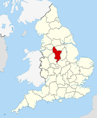
Use the interactive tourist map of Derbyshire to search for a range of local attractions, services and amenities. The county of Derbyshire is located in the East Midlands region, the county is known for being home to part of the Peak District National Park with its scenic countryside, open spaces and historic houses. Historic attractions in the county include Derby Cathedral and Chatsworth House. The county includes a number of attractions for visitors to explore, including a range of historic and family attractions.
Search for Derbyshire restaurants, cafes, coffee shops, bars, tourist information, visitor attractions including museums, art galleries, historic houses, cinemas, theatres, places of interest and much more. Use the map to better plan your trip to Derbyshire using the useful interactive tourist map, learn more about the county and the wide range of tourist attractions the county has to offer.
The map includes a location and area map of Derbyshire along with street view. Use the map to:
- Find directions for driving, walking, bicycling and public transport.
- Use the search function to find local attractions, dining, entertainment, services and amenities.
- Use the layers on the map to find information on local weather and forecast, travel information including traffic conditions showing the latest traffic flow and congestion.
- The photos layer includes photos relating to the map area from panoramio.
- The Distance tool shows a distance radius around a point on the map and can be used to calculate the distance between two points on the map.
Notable local attractions in Derbyshire include: Peak District National Park, Chatsworth House, St Mary’s Bridge Chapel, Derby Museum & Art Gallery, Derby Cathedral, Calke Abbey, Beehive Farm Woodland Lakes and Gullivers Kingdom Matlock Bath.
Local cities and towns in Derbyshire include: Derby, Matlock, Buxton, Leek, Ashbourne and Castleton.
English Counties sharing a border with Derbyshire include: Cheshire, Greater Manchester, Leicestershire, Nottinghamshire, South Yorkshire, Staffordshire and West Yorkshire.
To view the interactive Derbyshire maps please see: Map of Derbyshire - Local Search Map
Disclaimer: The information given in on this website is given in good faith and to the best of our knowledge. If there are any discrepancies in no way do we intend to mislead. Important travel details and arrangements should be confirmed and verified with the relevant authorities.