View Larger Map
Map of Rutland | Local Search for Attractions & Services
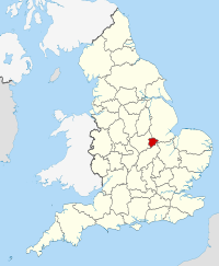
Use the interactive tourist map of Rutland to search for a range of local attractions, services and amenities. The county of Rutland is located in the East Midlands, the landlocked county is known for its compact size and scenic rural countryside. Rutland is perceived as being one of the quieter English counties, for visitors it is a hidden gem with historic houses, museums, gardens and a number of picturesque and scenic towns and villages. The county includes a number of attractions for visitors to explore, including a range of historic and family attractions.
Search for Rutland restaurants, cafes, coffee shops, bars, tourist information, visitor attractions including museums, art galleries, historic houses, cinemas, theatres, places of interest and much more. Use the map to better plan your trip to Rutland using the useful interactive tourist map, learn more about the compact county and the range of tourist attractions the county has to offer.
The map includes a location and area map of Rutland along with street view. Use the map to:
- Find directions for driving, walking, bicycling and public transport.
- Use the search function to find local attractions, dining, entertainment, services and amenities.
- Use the layers on the map to find information on local weather and forecast, travel information including traffic conditions showing the latest traffic flow and congestion.
- The photos layer includes photos relating to the map area from panoramio.
- The Distance tool shows a distance radius around a point on the map and can be used to calculate the distance between two points on the map.
Notable local attractions in Rutland include: Rutland Water, Oakham Castle, Normanton Church, Lyddington Bede House, Rutland County Museum, Rutland Railway Museum, Rutland Village All Saints Church Oakham, Barnsdale Gardens and Tolethorpe Hall
Local towns in Rutland include: Uppingham and Oakham.
English Counties sharing a border with Rutland include: Leicestershire, Lincolnshire and Northamptonshire.
To view the interactive Rutland maps please see: Map of Rutland - Local Search Map
Disclaimer: The information given in on this website is given in good faith and to the best of our knowledge. If there are any discrepancies in no way do we intend to mislead. Important travel details and arrangements should be confirmed and verified with the relevant authorities.