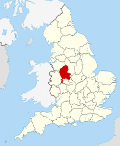
MidlandsRegionsstaffordshire-travel-guide

Discover the Historical and Modern Wonders of Staffordshire Maps

Exploring the rich tapestry of Staffordshire, we find ourselves drawn to the intricate maps that chart its history and geography. From the rolling hills of the Peak District to the bustling streets of Stoke-on-Trent, Staffordshire maps offer a window into the past and a guide to the present.

These maps aren’t just tools for navigation; they’re storytellers, revealing the evolution of landscapes, settlements, and industries over centuries. By delving into Staffordshire’s cartographic heritage, we uncover the hidden gems and historical landmarks that define this captivating county.

Key Takeaways

  • Rich Historical Insights: Staffordshire maps offer a detailed glimpse into the county’s evolution over centuries, illustrating changes in settlements, transportation routes, and industrial development.
  • Advanced Modern Mapping: Modern digital maps utilise advanced technology like GIS and satellite imagery, providing accurate and interactive views of Staffordshire’s current geography and infrastructure.
  • Specialised Maps: There are various types of Staffordshire maps tailored to specific interests, such as geological, historical landmarks, and topographical maps, each serving unique purposes.
  • Educational and Research Value: These maps are valuable educational tools that help students, scholars, and researchers understand regional history, geography, and environmental changes.
  • Collector’s Appeal: Historical Staffordshire maps are sought after by collectors for their artistic value and historical significance, making them cherished items at auctions and in private collections.
  • Contemporary Uses: Apart from their historical value, Staffordshire maps are essential for modern navigation, travel planning, and supporting urban development and conservation efforts.

An Overview Of Staffordshire Maps

Staffordshire maps offer a unique insight into the county’s rich history and diverse geography. Maps from different eras illustrate the transformation of its landscapes, revealing changes in settlements, transportation routes, and industrial development.

Historical Maps

Historical Staffordshire maps show the evolution of the region over centuries. For example, 18th-century maps highlight agricultural land use and early industrial sites, while 19th-century maps reflect the expansion of railways and urbanisation. These maps offer invaluable resources for historians and researchers.

Modern Maps

Modern maps of Staffordshire use advanced technology to provide accurate and detailed information. Digital maps incorporate satellite imagery and geographic information system (GIS) data, making it easier to explore the county’s current infrastructure and natural features.

Specialised Maps

Specialised Staffordshire maps focus on specific themes or interests. Examples include geological maps that display the county’s mineral resources and historical landmarks maps that guide visitors to sites of cultural significance like castles and ancient ruins.

Utility In Navigation

Staffordshire maps serve as essential tools for navigation. Tourist maps with points of interest help visitors discover attractions like the Peak District and Alton Towers. Local maps assist residents and businesses in planning routes and understanding regional connectivity.

Educational Value

Maps of Staffordshire provide educational value by helping students and scholars understand geography, history, and environmental changes. Schools and universities often use these maps in curricula to teach about regional development and conservation efforts.

Online Accessibility

Many Staffordshire maps are now available online, providing easy access for anyone interested in exploring the county. Websites of local authorities and historical societies offer digital map collections that present comprehensive views of Staffordshire’s past and present.

Collector’s Interest

Collectors often seek Staffordshire maps for their historical and aesthetic value. Antique maps of the county are cherished items at auctions and in private collections, reflecting the timeless appeal of cartographic art.

Historical Significance

Historical maps of Staffordshire provide insights into the region’s past, offering invaluable information about its evolution.

Early Mapmaking

The practice of creating maps in Staffordshire dates back to the medieval period. Early maps were hand-drawn and often inaccurate by today’s standards, but they serve as crucial documents. They reveal the boundaries of parishes, the layout of estates, and the extent of agricultural lands. John Speed’s 1611 map is one of the earliest detailed maps of Staffordshire. These early maps highlight the transformation from feudal landscapes to more organised settlements.

Notable Cartographers

Several cartographers have contributed significantly to Staffordshire’s mapping history. John Speed’s 17th-century maps, for example, set a high standard for detail and accuracy. In the 18th century, Thomas Jefferys produced detailed topographic maps, focusing on road networks and local landmarks. The Ordnance Survey, beginning in the 19th century, further advanced the accuracy and detail of Staffordshire maps, using state-of-the-art surveying techniques for the time. These contributions have created a rich repository of historical data, invaluable for understanding Staffordshire’s past.

Types Of Staffordshire Maps

Staffordshire maps provide various perspectives on the region, each serving unique purposes. By exploring different types of maps, we gain a deeper understanding of the area’s geography, history, and current landscape.

Topographical Maps

Topographical maps detail the physical features of Staffordshire. These maps show elevation changes, water bodies, and vegetation. They help hikers and surveyors navigate terrain accurately. The contours and symbols used make it easy to understand the county’s topography.

Historical Maps

Historical maps of Staffordshire offer a window into the past. These maps reveal how the landscape, settlements, and infrastructure have transformed over centuries. For instance, John Speed’s 1611 map showcases the early layout of towns and parishes. Collectors value these maps for their insight and artistic detail.

Modern Digital Maps

Modern digital maps use advanced technology, including satellite imagery and GIS data. These maps provide detailed and up-to-date information about Staffordshire’s infrastructure. Accessible online, they support various applications, from urban planning to tourism. Modern maps also feature interactive elements, enhancing user engagement.

By examining these types of Staffordshire maps, we appreciate the region’s evolving landscape and ongoing development.

Features And Landmarks

Staffordshire maps highlight a plethora of features, both natural and man-made, that define the county’s unique character. These landmarks offer insights into the area’s geographical diversity and historical significance.

Natural Landmarks

Staffordshire boasts several notable natural landmarks, each mapped in great detail. Cannock Chase, an Area of Outstanding Natural Beauty (AONB), features extensive woodlands, heathlands and wildlife habitats. The Peak District National Park includes areas like Dovedale, known for its picturesque landscapes and walking trails. Rudyard Lake, created in the 18th century, serves as a popular spot for boating and fishing enthusiasts. The River Trent, one of the major rivers in England, flows through the county, providing vital resources and scenic views.

Man-made Landmarks

Among Staffordshire’s impressive man-made landmarks, the iconic Trentham Gardens are meticulously detailed on maps, displaying the expansive Italian gardens, lakes and mazes. Alton Towers, one of the UK’s largest theme parks, is represented with intricate accuracy, showing its rollercoasters and attractions. The historic Shugborough Estate, once home to the Earls of Lichfield, showcases its preserved mansion and parkland. Lichfield Cathedral, a stunning example of medieval architecture, stands as a key mapped feature, alongside the Potteries, the centre of the UK’s ceramics industry, with factories and museums in Stoke-on-Trent marked precisely.

Collecting Staffordshire Maps

Collecting Staffordshire maps can be a rewarding hobby, providing a unique glimpse into the county’s rich history and evolving geography.

Where To Find Them

We can find Staffordshire maps in various places, often featuring diverse collections from different eras.

  • Antique Shops: Local antique shops often have historical maps, including rare editions from the 18th and 19th centuries. For example, Abacus Antiques in Leek stocks vintage cartographic pieces.
  • Online Marketplaces: Websites like eBay and Etsy offer a wide range of Staffordshire maps, from antique to modern. Searching these platforms can uncover unique finds, such as a 19th-century Ordnance Survey map.
  • Archival Institutions: County archives and libraries, such as the Staffordshire Record Office, maintain extensive collections of historical maps. Accessing these archives may reveal rare pieces, like those created by John Speed.
  • Specialist Dealers: Cartography specialists and dealers, such as Jonathan Potter Ltd, provide a curated selection of maps. These dealers often offer authenticated and preserved maps, including collectible editions.
  • Auctions: Auction houses like Bonhams and Sotheby’s frequently list historical maps in their catalogues. Participating in these auctions enables collectors to acquire high-value items, such as early hand-drawn maps.

Tips For Collectors

We must consider several factors to maintain a well-curated collection of Staffordshire maps.

  • Condition and Preservation: Ensure maps are in good condition; avoid those with excessive wear or damage. Store maps in a dry, dark place to prevent fading and mould.
  • Authentication: Verify the authenticity of maps, especially older ones. Look for provenance details and consult experts if unsure.
  • Historical Value: Focus on maps that highlight significant developments or changes in Staffordshire’s history. For instance, a map showing the expansion of the Potteries in the 19th century can be an invaluable addition.
  • Unique Editions: Seek out unique or limited-edition maps, such as first editions or those by renowned cartographers. An example includes a first edition of Thomas Jefferys’ map of Staffordshire.
  • Documentation: Keep detailed records of acquisitions, including purchase receipts and provenance information. This practice aids in tracking the collection’s value over time and assists future appraisals.
  • Networking: Join collector clubs and attend map fairs. Engaging with fellow enthusiasts provides insights and opportunities for acquiring rare items.

Collecting Staffordshire maps not only preserves historical artefacts but also allows us to delve deeper into the fascinating past of this unique county.

Using Staffordshire Maps Today

Staffordshire maps hold great value in modern applications, combining historical significance with contemporary utility.

Navigation And Travel

Today, Staffordshire maps serve as vital tools for navigation and travel. Digital maps, accessible via smartphones and GPS devices, help residents and tourists navigate the county. They provide real-time data on traffic conditions and route optimisation. For instance, apps like Google Maps and Waze offer detailed directions and alternative routes around congestion. Tourist maps highlight key attractions, such as Alton Towers and the Peak District, making travel planning straightforward. Heritage trails and walking routes in areas like Cannock Chase are clearly marked, offering hikers an enriched travel experience.

Academic And Research Purposes

Staffordshire maps are invaluable for academic and research purposes. Historical maps allow researchers to study changes in land use and settlement patterns over centuries. Universities use GIS technology to analyse spatial data, providing insights into regional development. Students in history and geography courses benefit from these detailed maps, which serve as primary sources for academic projects. The local council and planning authorities leverage modern maps to support urban development and conservation efforts. By examining environmental impacts and infrastructural changes, researchers gain a comprehensive understanding of Staffordshire’s evolving landscape.

Conclusion

Staffordshire maps offer a fascinating glimpse into the county’s rich history and diverse geography. From early hand-drawn maps to modern digital representations, these maps serve as invaluable tools for navigation, education, and historical preservation. They reveal the evolution of landscapes, settlements, and industries, showcasing both natural and man-made landmarks that define Staffordshire’s unique character.

As collectors and enthusiasts, we find immense value in these maps, whether for their historical insights or their aesthetic appeal. By exploring Staffordshire through its maps, we’re not just navigating a region but also uncovering stories that span centuries. Whether you’re a historian, a tourist, or a map collector, Staffordshire maps offer a rewarding journey into the past and present of this remarkable county.

Leave a Reply

Your email address will not be published. Required fields are marked *