View Larger Map
Map of Northumberland | Local Search for Attractions & Services
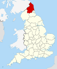
Use the interactive tourist map of Northumberland to search for a range of local attractions, services and amenities. The county of Northumberland is located in north east England, the county is the most northerly of England’s counties and shares a border with neighbouring Scotland. The county is noted for its scenic coastline and countryside and includes the Northumberland National Park and North Pennies - Area of Outstanding Natural Beauty. The county includes plenty of scenic countryside, coastline and plenty of open spaces along with a number of scenic small towns and villages. The county is sparsely populated and the lack of large cities and towns ensures it is a great place for a relaxing break.
There are a number of historic houses, museums, gardens and attractions including Wallington House and Garden, Dunstanburgh Castle and Bamburgh Castle. The county includes a number of attractions for visitors to explore, including a range of historic and family attractions.
Search for Northumberland restaurants, cafes, coffee shops, bars, tourist information, visitor attractions including museums, art galleries, historic houses, cinemas, theatres, places of interest and much more. Use the map to better plan your trip to Northumberland using the useful interactive tourist map, learn more about the county and the range of tourist attractions the county has to offer.
The map includes a location and area map of Northumberland along with street view. Use the map to:
- Find directions for driving, walking, bicycling and public transport.
- Use the search function to find local attractions, dining, entertainment, services and amenities.
- Use the layers on the map to find information on local weather and forecast, travel information including traffic conditions showing the latest traffic flow and congestion.
- The photos layer includes photos relating to the map area from panoramio.
- The Distance tool shows a distance radius around a point on the map and can be used to calculate the distance between two points on the map.
Notable local attractions in Northumberland include: Hadrian’s Wall, a UNESCO World Heritage Site, the North Pennies Area of Outstanding Natural Beauty, Dunstanburgh Castle, Bamburgh Castle, Wallington House and Garden, Berwick-upon-Tweed Barracks and Main Guard, Hexham Abbey & Northumberland National Park.
Local towns in Northumberland include: Morpeth, Amble, Ponteland, Bedlington, Berwick-upon-Tweed and Prudhoe.
English Counties sharing a border with Northumberland include: Cumbria, County Durham and Tyne and Wear. In the north of the county Northumberland shares a border with the Scottish Borders in Scotland.
To view the interactive Northumberland maps please see: Map of Northumberland - Local Search Map
Disclaimer: The information given in on this website is given in good faith and to the best of our knowledge. If there are any discrepancies in no way do we intend to mislead. Important travel details and arrangements should be confirmed and verified with the relevant authorities.