View Larger Map
Map of Mid Wales | Local Search for Attractions & Services
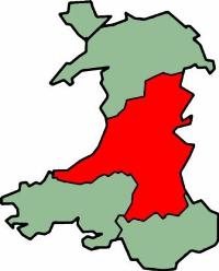
Use the interactive tourist map of Mid Wales to search for a range of local attractions, services and amenities. Mid Wales is an area that is relatively unspoilt with valleys, moorland and wooded hillsides offering some inspiring natural scenery and landscapes. The area does not have many large cities and towns making it an ideal place to relax and get away from it all.
The area includes scenic countryside and plenty of open spaces including the southern part of the Snowdonia National Park and the northern part of the Brecon Beacons. Mid Wales includes scenic small towns and villages along with a number of historic houses, museums, gardens and attractions including Llanerchaeron, Powis Castle & Gardens and Aberystwyth Cliff Railway. The county includes a number of attractions for visitors to explore, including a range of historic and family attractions.
Search for Mid Wales restaurants, cafes, coffee shops, bars, tourist information, visitor attractions including museums, art galleries, historic houses, cinemas, theatres, places of interest and much more. Use the map to better plan your trip to Mid Wales using the useful interactive tourist map, learn more about the area and the range of tourist attractions the area has to offer.
The map includes a location and area map of Mid Wales along with street view. Use the map to:
- Find directions for driving, walking, bicycling and public transport.
- Use the search function to find local attractions, dining, entertainment, services and amenities.
- Use the layers on the map to find information on local weather and forecast, travel information including traffic conditions showing the latest traffic flow and congestion.
- The photos layer includes photos relating to the map area from panoramio.
- The Distance tool shows a distance radius around a point on the map and can be used to calculate the distance between two points on the map.
Notable local attractions in Mid Wales include: The Cardiganshire Coastal Walk, Aberystwyth Cliff Railway, Llanerchaeron, Powis Castle & Gardens, King Arthur’s Labyrinth and Pistyll Rhaeadr.
Local towns in Mid Wales include: Aberystwyth, Cardigan, Llandrindod Wells, Welshpool and Newtown.
Neighbouring Areas in Wales include: Gwynedd, Denbighshire, Wrexham, Carmarthenshire, Pembrokeshire, Monmouthshire. English counties Herefordshire and Shropshire are located to the east.
To view the interactive Mid Wales maps please see: Map of Mid Wales - Local Search Map
Disclaimer: The information given in on this website is given in good faith and to the best of our knowledge. If there are any discrepancies in no way do we intend to mislead. Important travel details and arrangements should be confirmed and verified with the relevant authorities.